Sustrans Cycle Routes
What is it?
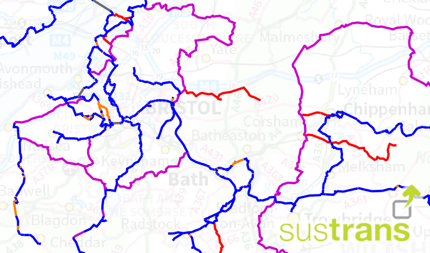
This is the National Cycle Network as designated out by Sustrans. It consists of three layers:
- National Cycle Network. A UK-wide network of more than 12,000 miles of signed paths and routes for walking, cycling, wheeling and exploring outdoors.
- Reinstated Routes. Reclassified routes, formerly National Cycle Network, are considered suitable for people who are confident and experienced at cycling. Sustrans continues to promote reclassified routes, including some long distance challenge routes, on our website.
- Removed Routes. Removed routes do not meet our vision of a network of paths for everyone. Our decisions about which sections of the Network to remove have been informed using objective criteria based on the best data available to the charity.
Where does it come from?
Sustrans
How often is it updated?
Every month.
What area does it cover?
The whole of the UK.
How might you use it?
This dataset may be useful for:
- viewing routes that are marked through your area
- providing guidance to the public on marked routes
- engaging with authorities and Sustrans about routes
- building in knowledge of routes into your neighbourhood plan
Data Licence
Open Database Licence (ODBl)
Technical Blurb
The layers are styled according to the type of surface. We have done this as it's the most important thing to consider when looking at the routes. For example, unpaved routes wouldn't be suitable for road bikes. The data has much more information within it, so click on each section to view information such as:
- It's route number
- Surface Type
- Quality
- Whether it's lit
- What road class it's on
Back to Category
MORE INFORMATION
